
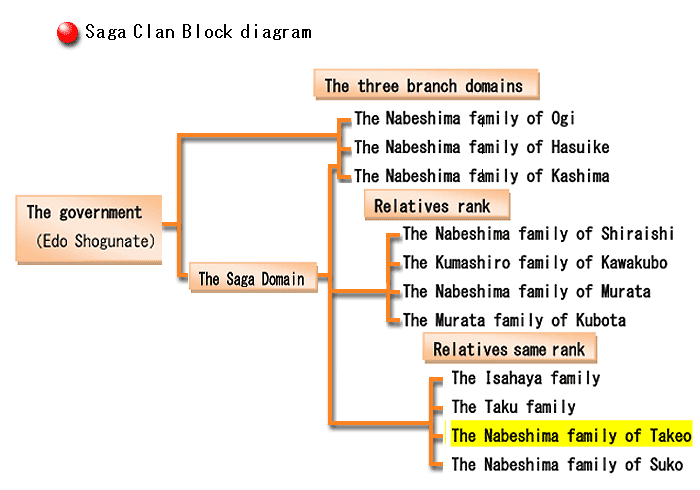
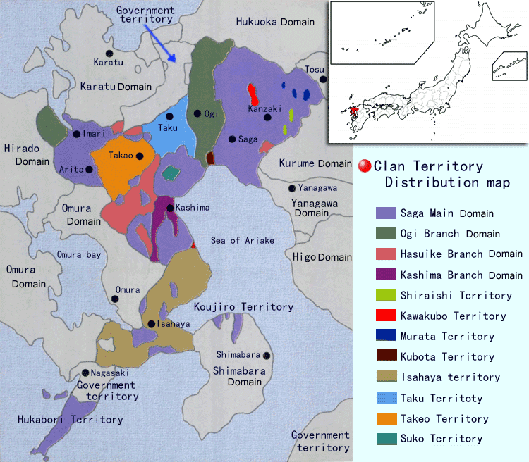
Saga Domain and the Takeo Territory
The lord of Takeo received roughly 19,900 koku* in a Shogunal charter from Hideyoshi Toyotomi in 1590. After the Nabeshima family took power in Saga, the government twice ruled that the Takeo Nabeshima family must pay 30% of their territory as tribute. Therefore, the Takeo Nabeshima family was left with 8,640 koku. The territory they gave to the government became a part of the main domain’s territory and a part of the Hasuike domain’s territory. The Hasuike domain was one of the three branches newly created around that time.
Throughout the Edo period, the size of the Takeo Nabeshima family’s territory ostensibly did not change but their koku and population were technically the same as a small-scale feudal lord.
The Saga domain had 357,000 koku shared among their three branch domains and various relatives. Consequently, the Saga domain only maintained direct control over 80,000 koku. The three branch domains were recognized as independent domains by the government but they were treated as vassals of the main Nabeshima family within the Saga domain.
*Koku is a unit of measurement that was used to determine land value in the Edo Period. While a koku is actually a measurement of volume based on the amount of rice needed to feed one person for one year, the koku used in land and tax evaluation does not measure the volume of rice harvested but rather measures the quality and size of land.

TOP
Copyright (C) Takeo City Library&Historical Museum